Trip Reports: Exploring the Kitasoo Coastline
August-September 1996
This is an article from WaveLength Magazine, available in print in North America and globally on the web.
by Howard Stiff

|
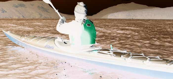
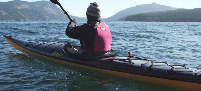
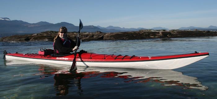
Brenda Gaertner paddles away from the new Mid-Coast ferry en route for adventure |
We took the new Discovery Coast ferry from Port Hardy on Vancouver Island up through the "Discovery Passage" to its most northerly destination, the Kitasoo village of Klemtu on Swindle Island. Swindle Island lies nestled in a continuous island archipelago at about the same latitude as the southern tip of the Queen Charlotte Islands. As this was the inaugural voyage of the "Queen of Chilliwack" to Klemtu, the 18-hour ferry ride felt like a cruise, with much fanfare and ceremony, including ritual Native dances, speeches and a seafood feast upon our arrival.
Our original plan was to paddle south from Klemtu to the Heiltsuk village of Bella Bella and catch the ferry home from there. The Klemtu locals however convinced us that there was plenty of excellent paddling in their area alone, and they were right. After studying the charts, we decided to circumnavigate the roughly wedge-shaped Swindle Island and return 8 days later to Klemtu. This would start us with a couple days of "inlet paddling" followed by a few days of "outside paddling". That night we parked our tent on a flat spot on a boat ramp as the proposed camping facility (and showers!) had not yet been completed.
On Day 1 we left Klemtu and paddled north on the east side of Swindle, a very protected passage due to closely spaced Cone and Jane Islands. The sky was overcast. The water reflected the unbroken tree line like a mirror. (In fact, we had seen no sign of logging since we left Vancouver Island - apparently because there is not a lot of "merch-antable timber" in the forests in the Central Coast area. Quite a treat.)
About 6 nautical miles north of Klemtu, Swindle Island comes to a sharp point - we crossed Tolmie Passage to a protected cove behind an unnamed islet off Sarah Island to find a place to camp. Campsites are characteristically difficult to find in these inlets as much of the foreshore is steep and rocky and the trees grow right down to the high tide line. It was also new moon when we began our trip, so the tidal range was at its greatest. We arrived at the time of the 12' high tide, and could see that there would be no soup and sandwiches.
On Day 2 we hopped back across the channel to the northern point of Swindle Island and headed south and west along Meyers Passage which separates Swindle from Princess Royal Island, home of the white Kermode or Spirit Bear. Although no bears were visible, I thought I could detect their presence in the Native rock paintings in the low bluffs that decorate the north side of the passage. 
As we pushed west, intermittent head winds, squalls, showers and sunlight had us donning and doffing layers of clothes and marvelling at how much variety inlets and channels afford the paddler. About 10 miles through Meyers Passage on the north side we came to an unnamed cove with a wide, braided estuary at its head. Above the beach rocks, grassy knolls (that were probably flooded in winter) led to a higher flattish field where we pitched the tent. On all sides, fresh water babbled down to the sea. Back at the high tide line, we tied up the boats and cooked our food, in case of bears. Or at least tried to cook - the stove died, its arteries terminally clogged with rust. Thus began our quest for fire in the soggy woodless inlets of the central coast.
Before we could get onto the water the next day, rain was pouring straight down on top of us and accompanying every item into the hatches as we packed the boats. I was reminded of an article by Deborah Robbins in a recent WaveLength: The Trick is Not to Mind the Damp - we used that title as a silent affirmation as we stuffed ourselves into our soggy wetsuits and set out.
On the water we headed out the last mile of the passage. The clouds were heavy and dark but still there was no wind. The rain was falling so hard the water surface resembled a field of bouncing ball bearings until it disappeared altogether into a continuous sheet of water seemingly from the clouds above us right down to the seabed 20 fathoms below. We realized right then that we would never see the sun again.
Fortunately we were wrong. The clouds seemed to coalesce again leaving room for solar highlights. The rain headed off in a dark bank to the northwest and as we turned south into the expansive Kitasu Bay blue sky broke out ahead of us. For the rest of the day the sun played hide and seek behind dramatic cloud formations and squally winds falling out from the river valley whipped up the waters out in the center of the bay. But we were happy to be out of the rain, close to shore and out of the wind, dipsy-doodling and trapping ourselves in inlets often indistinguishable from islets.
Later that afternoon we pulled out on a sweeping pebble beach lining the west side of the bay looking back to an unbroken string of pristine shorelines and low green peaks adorning the islands to the north of us. The mile long beach seemed to be a bit of an anomaly, sitting as it was in an otherwise very 'inlet-y' place. Anomalous shore geography turned out to be the norm though, as we were to find out over the next few days.
After spending a couple of sunny, almost hot, days on what we started to call Kitasu Beach, we resumed our journey. Departure day dawned bright and calm, with a slight breeze out of the northwest. We packed, re-debrised our campsite and set out on a low 2-foot tide. Through the clear water below we spotted white anenomes and then some surprisingly large blood-orange ones, open and waving in the current like some kind of submarine peony.
 |
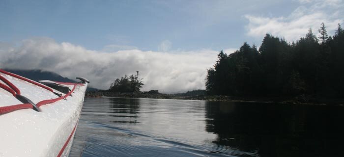
Steep shorelines are common and beaches rare |
Rounding the point, the breeze pushed us south over glassy waters along a massive headland of rock that would likely be challenging in any kind of windy weather. We were glad to be on the water early, having heard on the VHF that a high pressure system that was centered off the west coast of the Charlottes was building into something province-wide and would be resulting in gale force northwesterlies in some parts. Broken islands ahead of us promised protection but also a decision point as they marked the beginning of the passage between Swindle Island and the more exposed Price Island to the south, which, according to the chart, owned all the properties of coastal paddling, including reefs, rock gardens and the much-sought after sandy beaches.
We poked our way amongst the islets near the passage, probing the fractal geometry of rocks and scrubby trees for signs of the gap between Swindle and Price. Low tide height prevented us from exploring between the islets to our hearts' content, but the eagle-ridden moonscape of rocks above us and the forests of kelp sweeping below us kept us spellbound.
At the mouth of Higgins Passage the chart indicated a few potential camp spots in secluded coves, but they appeared boggy, buggy and none faced out west to the open ocean. The chart indicated several bays on Price that demonstrated the requisite west coast features. We were drawn south along Price.
We did not, however, get more than three or four miles. The promising bays on the chart did not exhibit much beach at all, let alone sand or pebbles. Instead, we found thin strips of soggy grass sandwiched between steep sharp rocky intertidal zones and boggy forest. Gorgeous paddling but not prime sea kayaker habitat. As well, the stiffening breeze seemed to be swinging around from northwest to west, becoming quite nasty as it tossed the water up against the bluffy shore in some of the more exposed places. Growing whitecaps covered the seascape and smashed themselves on the headlands ahead.
Losing hope of spending a few days peaking out to Japan on the west coast of Price, we dipped into a lagoon near Rudolph Bay to get out of the wind and break for lunch. A gentle flood swept us into a grass-ringed pool of tepid water. Except for the distant wail of a navigation buoy and the stirring in the tops of trees, it was as if the wind had suddenly died. A few bleached logs, like dinosaur bones scattered in the upper intertidal zone, attested to the massive storm energy this place sometimes experiences.
Due to consistent weather reports of increasing high pressure over the next few days, we decided to beetle back to the mouth of Higgins Passage when the wind dropped that evening.
Paddling north around 10 pm, as a great orange sun began to set, a little opening on Price near Higgins Passage caught our eye. We camped behind a protective islet on a grassy knoll sprinkled with Indian Paintbrush and buttercups, above a rocky beach near a natural, water-filled rock shrine, facing southwest. We pitched our tent on, yes, a pile of rocks which soon punctured my thermarest, but we stayed there two nights anyway, looking out to distant waves washing south, watching the line where inlet becomes outlet and where inside looks out.
IF YOU GO
Please respect the lands of the Kitasoo people and avoid trespass on sacred sites. Check with the band office in Klemtu for information before you depart.
ABOUT THE BC FERRY
Access-You can park your vehicle and walk onto the boat at Port Hardy. You can load some gear into your kayaks too, and place your boats on the kayak rack on the luggage cart in the parking lot. An attendant drives them on and off at your destination. Besides a carry-on pack, you should keep your charts, thermarests, tent and sleeping bags handy.
Accommodation-Do NOT try to sleep in the 'recliner seats' as suggested in the BC Ferry Corp brochure; the seats are inexplicably defective at remaining reclined for any length of time. But there's lots of space on the floor between the rows. Throw your thermarest there. Or you can pitch a tent on the aft deck. Showers are available on board.
Food-Better than average for ferries. You can pack some goodies up too but you can't use a stove.
NEXT TIME
Through Higgins Passage. See Part II


 This site uses valid HTML, CSS and Flash. All content Copyright © 2010 Wild Coast Publishing.