Georgian Bay's Western Islands: Ontario
June-July 1999
This is an article from WaveLength Magazine, available in print in North America and globally on the web
by Adrienne Montgomerie
What's the worst that could happen?" You can capsize and die," says an onlooker.
"That's not going to happen," I say. "At worst we're blown off course and after four hours of paddling we have to turn back."
We're planning an open water crossing to the Western Islands-the most exposed group of islands on the east side of Georgian Bay. To many Georgian Bay is Canada's sixth great lake, far more than a bulge off the east end of Lake Huron.
 The shores and countless shoals of the Bay are so smooth they often seem to merge with the waves. The constant wind has inscribed itself so deeply as to create the distinctive "Georgian pine"-a calling card for the whole region.
The islands we seek lie midway down the eastern shore of the Bay, more than twenty kilometres from the mainland. The Western Island group is the only thing to puncture the horizon between Parry Sound and Lion's Head, on the Bruce Peninsula. The islands are an oasis, lush with plant and animal life, and a haven where untold numbers have weathered a storm.
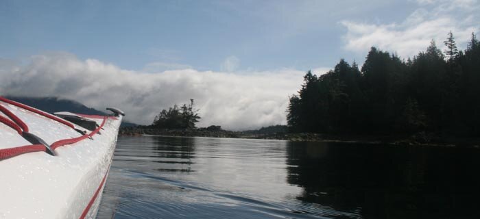
Whether you set out from the Umbrella Islands or'Donnell Point, there will be only the compass to guide you. From kayak level the thin blue horizon alone calls you forward. Half way across you can barely make out a dark bump to the west, and the mainland has receded into the sky behind you.
It's an eerie crossing to make. Once you leave the main boating channel, solitude sweeps over you with each stroke. Sunken vessels pass unheralded beneath your boat, the occasional bird glides overhead, and the sound of your breathing becomes hypnotic
As the land rises to greet you, you are torn from your trance by the cacophony of gulls. While cormorants are the most common bird on this side of the Bay, out on the Westerns, seagulls reign. Broken eggs strewn about the island tell tales of silent raids and the cycle of life. Atypically for the Bay, these islands are covered by tall trees, patterned lichens, snakes, shallow water bays, and an elevation that lets you barely see the mainland to the south.
Between the Nature Reserve, National Park, and private islands, the closest sanctioned camping spot is found to the north, on the Umbrella islands-a set of small bulbous islands whose name could not suit them better. Coming out of Twelve Mile Bay you pass through'Donnell Point Provincial Nature Reserve Park, and the northern-most islands of Georgian Bay Islands National Park. All "use" is prohibited in these protected areas. The proliferation of privately owned islands in this bay make these protected zones a blessing, but an inconvenience for paddlers in search of a lunch or camp spot. There is campable crown land sprinkled amongst these islands, although it's not marked on official maps.
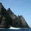
 |
Characteristic glaciated rock of Georgian Bay. |
There are many good campsites on the Umbrella islands, a respectable distance from the fragile vegetation. As wood is scarce to non-existent and fires leave ugly black marks and crack the rock, a good camp stove and plenty of fuel are essential. There are no outhouses on these islands as yet but the limited visits they receive make cat-holing a viable alternative.
The water between the islands is tropical in colour, but the temperature barely reaches 10°C (50°F) in the height of summer.
The island at the southwest end of the group is home to one of the last remaining wooden lighthouses on the Great Lakes. Built in 1895, the 18 meter tall beacon was staffed by a string of "keepers" and their families for more than 90 years. Isolation was a way of life for these light-keepers. Dropped off at the first sign of thaw by the St. Heliers out of Midland, the 17 keepers and their families came prepared: 100 lb. bags of sugar and flour, 50 lbs. of powdered milk, months' worth of pickled eggs, canned fruits and vegetables, several sides of bacon, and correspondence courses for the kids.
As the keepers stayed until winter claimed the Bay they experienced no end of inclement weather. They were sometimes barricaded in the house for days while storm driven waves beat at the shutters and lightning threatened the tower. Cleats were standard issue for the keepers as late fall waves caked every surface in ice. Even the safety line that flanked the walkways could be a foot thick with ice before the job ended for the winter.
 |
One of the last wooden lightwhouses on the Great Lakes |
When the last keeper finished his posting on "Little Alcatraz" in the late 80's, the Coast Guard spent days trying to destroy the "dwelling" with axes and crowbars, and even after they resorted to dynamite the chimney was still standing. All that remains today is the stark white light-tower on a brilliant bed of orange lichen, and the skeletal remains of dwellings more than a century old
ROUTE
Option 1: 84 km-Depart government dock at Snug Harbour north-west of Parry Sound. Camp at Umbrella Islands, via Cathcart Island (aprox. 23 km). Then to camp on Harbour Island in Western Islands group (aprox. 17 km), with side trip to see lighthouse on Double Top Island (aprox. 20 km round-trip). Take out at government dock just east of Chippewa Island in Twelve Mile Bay (aprox. 24 km), or one of the private Marinas.
Option 2: 42 km-Depart government dock in Twelve Mile Bay. Cross to Westerns and camp. Day trip to Double Top Island's lighthouse and explore the rest of the group. Return to put in.
MAPS
Sans Souci 41 H/1 for Twelve Mile Bay and Western Islands, and 41 H/7 & H/8 for the northern portion.
Crown Lands maps are available from local !Ministry of Natural Resources offices. For a map that covers the region from
Algonquin Park to Georgian Bay, and south from North Bay to Port Severn, send a cheque or money order for $9.78 to the Minister of Finance care of the MNR at 7 Bay St., Parry Sound, ON P2A 1S4, or call with your credit card number and they'll mail it to you right away. Crown land is "owned" jointly by all Canadians and as such is free for them to use. Foreigners must obtain a permit and pay the appropriate fee before venturing on Crown Land.
PROTECTED AREAS
Fifty-nine barren glacier-scraped islands make up Georgian Bay Islands National Park. Highlights include interpretive trails and the windswept pines which inspired Canada's famous Group of Seven artists. There is no camping on northern islands as they are earmarked for preservation. All islands were signed in 1996 so there should be no question as to which islands are protected.
The spotted turtle, hog-nosed snake, fox snake, and Massasauga rattlesnake are among 34 species of reptiles and amphibians found in'Donnell Point Nature Reserve Park. Some are rare, and many are at the northern limits of their range. More white-fringed orchids grow at'Donnell Point than anywhere else in the province. Topographical features include an undisturbed Georgian Bay shoreline of coastal bedrock, upland and lowland forest, and extensive wetlands. There are no visitors facilities on this 875 ha Nature Reserve 50 km south of Parry Sound. Visitors are asked to respect the fragility of the park's ecology.
For more information see:
http://www.mnr.gov.on.ca/MNR/parks/odon.html or call Oastier Provincial Park at 705-378-2401
www.pc.gc.ca/pn-np/on/georg/index_E.asp or call the park office in Honey Harbour at705-756-2415.
GEAR AND RENTALS
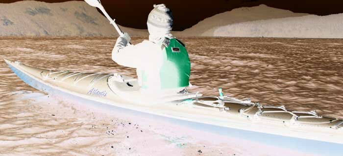
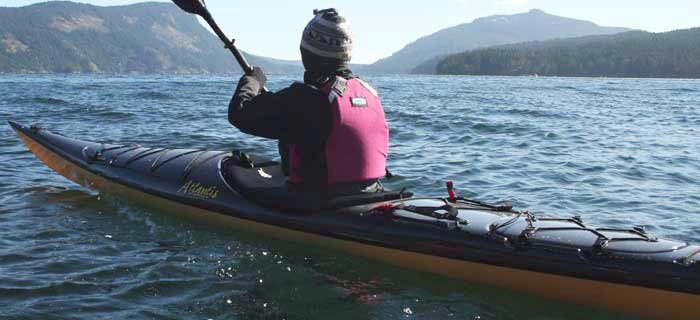
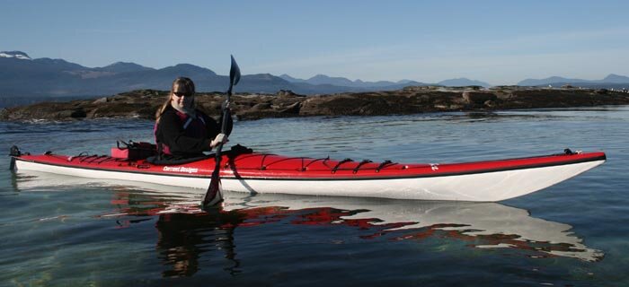
While historically adventurers challenged rougher waters in lesser boats I'd recommend a sea-kayak for this crossing, and at least a couple of paddling buddies. Kayak rentals are available from White Squall in Nobel, just north of Parry Sound; or to the south from Northern Lights in Barrie.
White Squall Paddling Centre, Carling Bay Rd., Nobel, ON (705) 342-5324 http://www.whitesquall.com/
Northern Lights Canoe & Kayak Ltd., 1 1 0 Saunders Rd., Barrie, ON (705) 735-0079 northern@bconnex.net
Adrienne Montgomerie is a freelance writer and wilderness tripper living in Parry Sound, Ontario. In her spare time she fights fires and teaches wilderness first aid.


 This site uses valid HTML, CSS and Flash. All content Copyright © 2010 Wild Coast Publishing.