

The land of totems
A disappearing heritage marks Gwaii Haanas National Park
From the Summer 2010 issue of Wavelength Magazine. Read the entire magazine online.
by James Dorsey
On the southern tip of a windswept archipelago sixty miles off the coast of mainland Canada lies the last disappearing remnants of a rich artistic heritage.
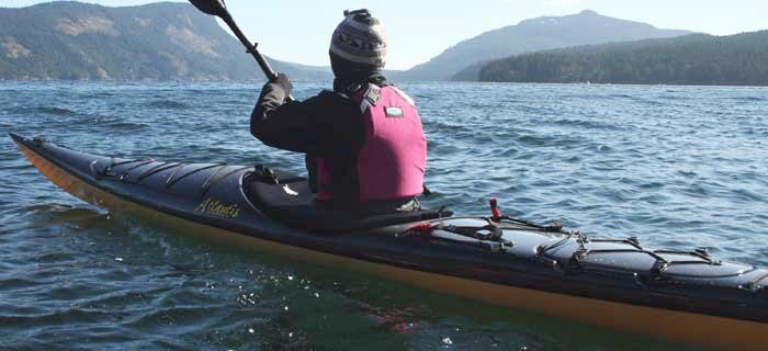
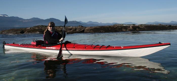
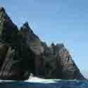
For the intrepid paddler willing to challenge the swirling rips and eddies that stand watch over this isolated destination, the rewards are great, but it is not for the fainthearted. The unparalleled beauty of these islands sometimes clouds the reality that one is paddling through open oceans where a kayak can be sucked under like a toy in a bathtub. But for an ambitious sea kayaker, this is a dream destination – a perfect combination of challenge and reward.
The early people called this land XaaydaG a Gwaay.aay or “Islands at the Boundary of the World.” It has since been shortened to Haida Gwaii, or “Land of the Haida.” Once officially the Queen Charlotte Islands, the name was changed to Haida Gwaii on Dec. 11, 2009. The land represents more than 3,600 island in all, with an oral history that can be traced back 7,000 years. The Haida have always been of the sea, and this land is a siren call for kayakers.
Tucked into a sheltered cove on the East Side of Anthony Island, the once thriving village of SGang Gwaay (or Ninstints) is guarded by the greatest still-visible achievement of the Haida Nation. Twenty six massive totem poles, carved by masters, watch over the spirit of this land. I arrived on a tiny coastal seiner with four kayaks lashed to the roof of the wheelhouse.
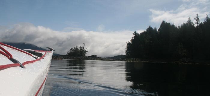
These are the most treacherous waters I have paddled, calm and welcoming one moment and the next a raging chorus line of massive waves fueled by unimpeded winds. But by hugging the coast we plan to not just avoid the open ocean but enjoy one of the most colorful and unpolluted littorals anywhere. Traveling by mothership affords us the local knowledge of our Haida skipper and his tidal maps to study in the evenings.
We put in at Skidegate, the old Haida village named for its original chief, Skit-Ei-Get, and head south to play leapfrog among the countless specks of islands that form the eastern side of this archipelago. At this point the current is leisurely, allowing us to study the landscape as we pass by and I am able to dally in small coves to watch predatory sea stars overwhelm smaller prey.
Paddling here, one is blanketed with a sense of history thicker than the morning fog, realizing that these same waters were once churned by some of the most formidable warriors known on earth, once considered the Vikings of the North, sea raiders who gave no thought to crossing 60 miles of open ocean in a hand carved boats. To follow in their wake is to go back in time. I am awed not just by the natural wonders of the land but the overwhelming history that surrounds my boat.
The earliest recorded information on these islands comes from Spanish explorer Juan Perez, who discovered them in 1774. A decade later, Russian fur traders began to frequent them, and for the next century were the only non-native visitors. The islands got their current name from the flagship of Lord Howe, HMS Queen Charlotte. The ship’s namesake was the wife of King George III of England. The fur traders were the first kayakers to visit these islands, having mastered how to handle the early skin boats from the coastal tribes of Inuit and Inupiak people in what was then Russian Alaska. It was on these boats that the first sophisticated tools came over that would change the destiny of the islands.
Before white contact, the Haida people had already raised carving to a high art form. The introduction of metal from the fur traders allowed them to fashion new and more efficient tools, increasing their skills tenfold. The Haida carved wood on a monumental scale. House columns, commemorative totems, burial boxes and even ornamental bowls were all of the highest order, but their massive cedar canoes were known and feared along the entire coast as far as today’s southern Baja, where legends say they traveled to gather slaves.
We encounter big rolling whitecaps the second day with a building surf that forces us off the water early. Retreating to the mothership we find a tiny cove and lay out anchors bow and stern as our skipper says it will really blow in the evening. We spend the night huddled around the shortwave listening to this massive storm sink an Alaska ferry while we reset our dragging anchors every two hours in a blinding rain. I keep my nose in a photo book of the massive totems and follow the story of a Haida chief named Tahayren, who later took the white name Charles Edenshaw and went on to be acknowledged as one of the finest carvers to ever live.
Upon his death, his carving tools were passed on to his nephew, Charles Gladston, who is the grandfather of Bill Reid. Reid, whose Haida name was Iljuwas Yalth Sgwansang, died only a few years ago. During his life he continued the great tradition of carving and started a resurgence in the artform among young Haida. Today the work of Reid and Edenshaw resides in the world’s finest museums as examples of the epitome of Haida carving.
In the morning, we set out under cerulean skies. The tempest has past.
By day three of our journey I am enthralled by all the eagles who seem as interested in me as I am of them. I hug the coast tightly, venturing into tiny passageways that become magical tunnels. Otters scamper out of the water directly ahead of my boat, chittering as they streak up a flat boulder. I pass directly under a massive eagle’s nest on a low, sweeping branch that reaches over the water.
A glint of sunlight lasers off the back of a passing salmon and brings my attention to a forest of purple anemones under my keel, probably where that pack of otters was having breakfast a few moments ago.
At the apex of Haida culture, close to 14,000 people occupied Haida Gwaii with almost 300 living in tiny Ninstints. The village name is a western mispronunciation of Nan Sdins, who was chief at the time of white contact. Today, Ninstints is officially called Sgang Gwaay LInagaay. Around 1860, small pox was introduced to the islands by white fur traders and soon only about 30 people were left alive. By 1911 the total native population of the islands stood at 589. Ninstints was totally abandoned around 1880.
On day four, a squadron of eagles has laid claim to a tiny finger of rock pointing into the ocean, crisscrossing each other in front of my boat as they make dramatic plunges to grab young salmon. One young bird drops his prey, almost hitting my deck, and screeches angrily as he dive bombs my boat, blaming me for his loss.
As we drift around the island’s southern terminus the surging ocean carries us into the tiny sheltered cove that forms a natural amphitheater for viewing the giant totems. Bobbing there, on the edge of the open pacific in the presence of this monumental art and history, was one of the most emotional moments I have ever had on a paddle trip.
We glide ashore on the pure white sand as I imagine the sound of war canoe keels being dragged up to rest in front of ancient longhouses.
The poles are bleached almost white from the sun and their storied faces are for the most part worn smooth by the relentless Pacific winds. Yet there is still much to be seen. Several mortuary and one memorial pole that once held wooden boxes with the remains of Haida men and women line the beach like soldiers on watch. The early people buried their dead by compacting their bodies into a tiny wooden box that was placed at the top of a burial totem in front of the family lodge. The carvings on the totem were their personal crests.
At the height of Haida culture, their villages, which always sat on the shoreline, were all adorned with dozens of totems as well as large carved support poles for their long houses. Their canoes and paddles were carved and decorated, and they made functional clothing from the bark of cedar trees. These people spent their lives in and of nature and the art they created from it.
A totem can commemorate a birth, death, a great feast or a war victory. Any great event in the life of a village or chief could be cause for a carving, but the exact meaning of all these poles is now buried with their carvers. I can decipher a beaver, a thunderbird, a sea bear. But that is all. To walk among them is to feel the presence of the people who carved and lived beside them. While they stand, this village still lives.
In 1981 Ninstints was declared a World Heritage Site by the United Nations Educational, Scientific and Cultural Organization (UNESCO), guaranteeing its preservation for the immediate future. In 1995 the remaining poles were straightened, but the elders made it clear in the future the poles will stand or fall as they may, eventually returning to the earth to nourish the next generation of trees. Until that day they stand as silent sentinels, representing the epitome of a culture’s artistic heritage.
Compared to most major paddling destinations, Haida Gwaii is quite isolated. One must remember that you are 60 miles out in the open ocean in an area known for its severe currents and weather that can change in an eye blink. But for those hardy and experienced kayakers seeking to pit themselves against nature, there is no more rewarding place to dip your paddle.
James Dorsey’s website is www.jamesdorsey.com
If you go:
Facilities in and around Gwaii Haanas are minimal. There are no roads, stores or maintained hiking trails. Beyond two water hoses for services you’re on your own. Tours by kayak and/or mothership are a carefree way to minimize hazards and hardship. Three regional tour operators are listed on the top of the next page (online magazine version only -- follow the link above). For self-guided tours, the closest boat launch is at Moresby Camp, a private industrial site on Moresby Island. Check with the Visitor Centres for travel protocol.
Hazards such as Louise Narrows and Porter Head require careful navigation – the narrows for the currents (travel with the tide) and Porter Head for its winds. To get to Porter Head, the northern border of the park reserve, from Camp Moresby is about two days by kayak. A myriad of other hazards exist on the way to SGang Gwaay; plan for several weeks to make the journey and always have backup plans in the event of inclement weather. Once there visitors must go ashore from the northern bay and walk on the boardwalk to the Haida Gwaii Watchmen cabin to sign in. For more information, visit www.pc.gc.ca/eng/pn-np/bc/gwaiihaanas/


 This site uses valid HTML, CSS and Flash. All content Copyright © 2010 Wild Coast Publishing.