Central Coast Paradise
June-July 2003
This is an article from WaveLength Magazine, available in print in North America and globally on the web.
To download a pdf copy of the magazine click here: > DOWNLOAD
by Gordon Baron

Imagine - paddling across intricate networks of isolated coves, secluded bays and remote lagoons; drifting over undersea gardens of red, green and purple sunflower stars and sea urchins edged with emerald green surf grass; watching crabs clinging to floating forests of kelp swaying with the current; exploring remote sand beaches with trails winding through plateaus of soft vegetation and stunted windblown trees; crossing fields of waterlilies to viewpoints high above the surf; enjoying the tranquillity as you watch the sun sink into the Pacific Ocean.
You've just imagined the Hakai Provincial Marine Park, the largest marine park in British Columbia, covering an area of 122,998 hectares. Established in 1987, the park is located 130 km north of Port Hardy and 120 km west of the pristine valley of Bella Coola. The historical fishing cannery of Namu is the closest settlement, 10 km northeast of Hakai Passage. This old winter village site of the Heiltsuk people from Bella Bella is the oldest continuously inhabited site along the BC coast, dating back 10,000 years.
The challenging waters of Hakai Passage have been the home of First Nations people (Heiltsuk, Oweekeno and Nuxalk) for generations. Abandoned villages, middens and fish traps make this area the richest concentration of archaeological sites in British Columbia.
Most visitors to this area come for the fishing and travel by means of float planes or private boats to one of the numerous fishing lodges. But times are changing, and in 1996, the BC Ferry Corporation opened up this pristine wilderness to the paddling public with the Discovery Coast Passage ferry Queen of Chilliwack. From the Bella Coola and Port Hardy terminals, BC Ferries supplies trailers that transport your loaded kayak onto the vessel. They have also designated drop-off and pick-up sites along the route ('wet launches') which cater to kayakers. Making prior arrangements or calling the vessel from your portable VHF will ensure a pick-up on one of its return voyages. (www.bc ferries.com)
 |
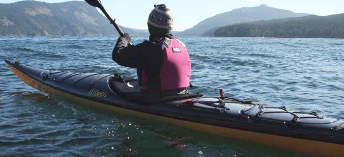
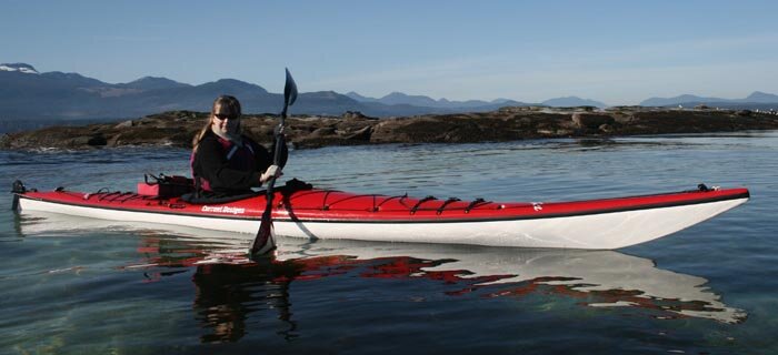
If you want isolated, unpopulated beaches, the Central Coast is for you. |
The first drop-off/pick-up point for the northbound ferry in the Hakai Recreation Area is the southern entrance to Kwakshua Channel on Fitz Hugh Sound. From this point you can paddle 5 km west into Kwakshua Channel. The red roofs at the head of the inlet at Pruth Bay are a private land based fishing lodge. Here, Kwakshua Channel makes a 90 degree turn to the north and continues into Hakai Passage.
To the south is a Telus Repeater Station and a Provincial Park Lookout which is well worth exploring. A trail starts in the southern arm of Keith Anchorage at the barge unloading ramp and heads east to a shallow lagoon where the caretaker's house once stood. From here it is about a 30minute walk to the lookout. The Telus Station is fenced off but walking around the edge of the fencing leads to the Heli Pad lookout and an excellent view looking north into Hakai Passage and the islands beyond. This is a good spot for lunch.
Leaving Keith Anchorage, paddling north in Kwakshua, you will start feeling the Pacific swells. Sealife becomes more abundant. In the distance you may see spray from hundreds of white-sided dolphins jumping for joy on a feeding frenzy, or a small pod of orcas cruising the shoreline looking for the next meal. From above, eagles watch your every move and behind you, Stellar Sea Lions breathe loudly. It's a warm sealife welcome to Hakai Passage.
It's very important to pay close attention to the weather patterns and to listen to the updated VHF Marine Weather "Sea State" forecast. As beautiful and serene as Hakai may seem, it is not a place for the timid or inexperienced kayaker. Hakai is noted for treacherous currents and violent winter storms. As the sun moves north in the spring, westerlies become weaker and storms less frequent, occasionally rising to gale force. In late summer, as warm air moves over the colder Pacific Ocean, sea fog is created. So crossing Hakai Passage or Fitz Hugh Sound should be accomplished in the morning, before the afternoon sea breezes begin. Keep the local Tide Tables close at hand. Tides can range up to 16 feet and the combination of gale force winds on an ebbing tide is very dangerous. It's important to do your homework before crossing.
 |
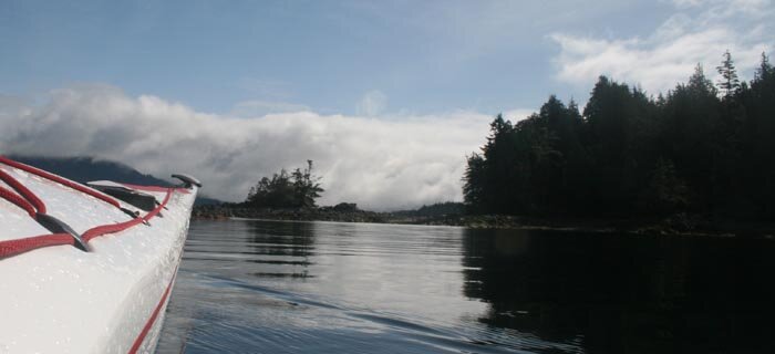
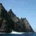
Rugged beauty everywhere you look. |
Rounding the northern tip of Calvert Island, you are partially sheltered by Rattenbury, Donald, Odlum and Starfish Islands. Heading southwest past Adams Harbour into Choked Passage brings you into excellent fishing grounds. Specials of the day for your dinner seafood platter include halibut, cod, wild salmon, crab and prawns.
BC Parks has two wilderness campsites in the southwest end of Choked Passage at Wolf and North Beaches. Wolf Beach is smaller and more remote. A stream flows from the lagoon behind the beach to the sea. The dominant red cedars colour the lagoon and stream a rusty brown, making the water unsuitable for drinking but great for washing your hair.
The long, sandy North Beach is the last beach before Surf Islands and the open Pacific. This is the limit for the intermediate paddler. North Beach is an ideal location for a base camp and day excursions, both for paddling and hiking. The trail system starts here, connecting a long chain of beaches. A twenty minute trail winds through the rain forest, crossing scenic lagoons and ending at the breathtaking West Beach and the open Pacific Ocean.
Kayaking to West Beach through the Surf Islands and rounding the western tip of Calvert Island is challenging, with open surf rebounding off the rocks between the reefs meeting the next incoming wave. The entrance to West Beach is scattered with islands and reefs which give partial protection for landings at high tide. The property above West Beach is privately owned so camping is not advised. This is the most popular beach on Calvert Island because of the short trail access from Pruth Bay which boaters have long used for safe anchorage. The trail begins in front of a private lodge on Pruth Bay. The owners welcome transients, both to the classy gift shop and to the dining room.
|

A trail starts at the south end of West Beach consisting of bridges, ladders and boardwalks, winding through lush green rain forest, crossing bogs of bright yellow hooded skunk cabbage, climbing above towering granite cliffs to viewpoints, descending to the shoreline and joining six remote sandy beaches. Access to the beaches is easiest at medium to low tides, when you can bypass the boggy trail along the shoreline. This secluded area is the nicest on Calvert, with very little walking traffic from Pruth Bay because of the tides and the distance. Depending on the surf, paddlers may have this area to themselves. Rugged beauty everywhere you look. Paddling south to Bolivar Islet and 3 Mile beach is a distance on the open sea. This is the longest and wildest beach in the Hakai Recreation Area. The breakers here make landing and exit from a kayak difficult, putting a new meaning to the term "wet exit."
Biodiversity, dramatic combination of marine ecology, forest organisms and geological formations makes the Hakai Recreation Area a paradise for the visiting kayaker to enjoy - and a necessity to protect.
© Text and photos by Gordon Baron who has spent years helping to restore the fading history of the Central Coast's abandonned canneries and rescue trails.
Ed. Note: BC Parks and the Heiltsuk people are hoping to join forces to better protect the environmental impact of visitors and the native ancestral history surrounding the Hakai Area. Leave No Trace camping is a priority.


 This site uses valid HTML, CSS and Flash. All content Copyright © 2010 Wild Coast Publishing.